Snowdon... the pictures
Well here are my pictures from yesterday. They were taken with my phone, so sorry for the poor quality. I couldn't find my digital camera!
On the road...
When I saw Snowdon in the distance, I had to pull over and take a picture.

Mysti
After 2 hours in the car, Mysti was up for a bit of running. This is the Miners track, a nicely graveled surface and practically no slope.

Moutains in cloud
A breath taking view I had to take a picture of. At this point, I still didn't actually believe I'd go up, so I was happy to admire its beauty from afar. That said, most of it is under cloud.

In the distance
Just went around a corner, and Snowdon showed itself again, but still a way off in the distance. Starting to be able to see some of the snow on top.

Lake
Just about to cross the first lake, there's a convenient causeway so you don't have to paddle. Not that Mysti would have minded that! The path hugs this lake around the point, and then starts to climb a little.

Waterfall
I didn't take a picture, but I'm now well above the first lake, which is down to my left. At this point I can't really take my eyes off Snowdon, still wondering if I'd have a go or not!

Snowdon
At the second land. This picture really doesn't do Snowdon justice. At this point - it is absolutely enormous. The next pictures don't really give it perspective either. Don't believe me? Come with me next time!!

First climb
The lake below is where I took the previous picture from. This picture shows the scree slope that we had to scramble up. Mysti of course made didn't have any problems - apart from one slide which was actually really quite funny!

Snowdon with cloud coming down
Now on the Pyg trail after the scramble up from the Miners track, Snowdon looking very close, and the summit, which still high above me, looking beatable. I'd decided now I was going to go for it.

Lakes below
The lakes below are now a distant memory, while my ascent up to the summit gets under way. This is still following the Pyg track, well before getting close to the zig zags.

Summit still some way off
The summit, still poking into cloud, it looks close, but I was still painfully aware there was still a lot of 'up' left. By this point, my legs were starting to tire after walking for about 2 hours on rough and steep ground.

Into cloud
Now I was up with the clouds. The most bizarre thing here, I could hear seagulls! What the bloody hell were they doing at 3,000 feet? This was taken on the last bend before I started up the zig zags. I didn't take any pictures of that, because, frankly, I was terrified! The track became deep with snow and ice. Pictures were the last thing going through my mind! The wind here was horrific too.

The summit
Having left the zig zags alive, I took a left, and carried on walking up to the summit. The summit appeared out of the thick cloud, against a back drop of, errr, more cloud. The structure on top is the trig point mounted on a cairn.

A plaque on the trig point
Just had to take a picture... not sure why. I didn't actually stop to admire this, I was still pretty keen to get out of the cloud.

Mysti - the highest dog in Wales (and England!)
Mysti with absolutely no idea she's now quite literally top dog!

Below the cloud line
Broke out of cloud and could start to enjoy some of the scenery.

Mysti, again
Mysti just looking cute really.

Looking back towards the summit
Just thought I'd take another picture to remind myself how rubbish the weather was!

Zig zags
Looking down over the zig zags I came up Very steep, and the paths themselves are covered in snow. Look how steep the slopes are if you slipped. Ouch! This was the clincher for me, I was going down another way!

Better weather
Once I'd lost the height off the mountain, I was back into nice weather and blue skies and a fantastic view to boot.

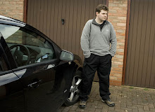
Llanberis after a cheeky pint
After a well earned pint in Llanberis, I caught a taxi back to my car. Because I'd taken a safer route back down the hill, I was about 6 miles from where I intended to be, and couldn't really be bothered to walk up the road.

posted by 3 Peaks Paul @ 20:13
![]()

1 Comments:
Very enjoyable read - but rather read about it than do it :)
Post a Comment
Subscribe to Post Comments [Atom]
<< Home